The state will need a lot more rain and snow to refill record-low water reservoirs.
:format(webp)/cdn.vox-cdn.com/uploads/chorus_asset/file/24339199/1454328822.jpg)
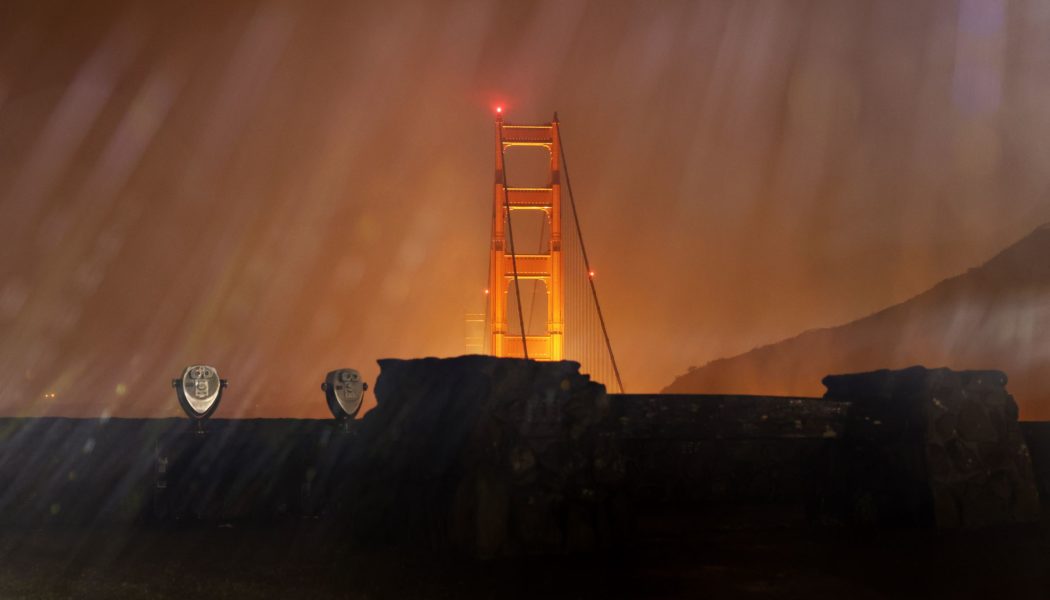
A deluge of storms is dumping serious amounts of rain across notoriously dry California. Even so, this week’s downpours are still nowhere near enough to pull the state out of its intense years-long drought.
A bomb cyclone is working its way across the state today, flooding homes and roads and knocking out power for hundreds of thousands of residents. Officials warned it could be the worst storm to crash into California in years — even though it’s just one in a series of storms to pass through in the span of a couple weeks.
It all comes on the heels of a long dry stretch for the Golden State. 2022 marked the end of the driest three-year period for the state on record. But in a dramatic shift, California rang in 2023with wet weather — with more on the way over the next week or so.
The downpours are expected to bring some short-term relief. About a month ago, around 85 percent of the state was in the midst of “severe drought,” according to the US Drought Monitor. That’s since fallen to about 71 percent. But California needs more consistent rain and snowfall to bring that number down much further.
“We need this stuff to happen this month, February, March, April — every month to really build up the snowpack, fill up those [water] reservoirs and knock down those [precipitation] deficits,” says Richard Heim a meteorologist with the National Centers for Environmental Information. “Unfortunately, a lot of it is coming too fast, too heavy.”
A powerful atmospheric river, which is pretty much a river of water vapor high up in the sky, reached the state yesterday. It’s alsocalled the “Pineapple Express” and brings in moisture from Hawaii and the tropical Pacific to the west coast of the continental US and Canada. This particular storm system has developed into a bomb cyclone, meaning it has rapidly intensified. That’s causing dangerous downpours and heavy snowfall. The National Weather Service warned of “extremely heavy snow rates” above three inches per hour at high elevations. Meanwhile, “rapid water rises and mud and rock slides” are possible along the coast and Sacramento Valley as rainfall quickly accumulates at a rate of an inch an hour.
This is actuallythe third atmospheric river to batter the state in the past week. The last one struck over New Year’s weekend. And there are two more forecast to sweep through next week. While the recent rain might seem like a drastic turn from how parched the state has been over the past few years, this sodden string of wet weather is actually more of a return to normal — what California might expect if not for persistent drought.
“We’ve been having what amounts to normal winter storms, but we’re just not used to seeing normal winter storms because we haven’t had many in recent years,” says Jeanine Jones, drought manager for the California Department of Water Resources. “People have kind of forgotten what normal looks like.”
The state recently came out of its longest drought, which lasted from 2011 to 2019, since the Drought Monitor got started in 2000. Looking at the region more broadly, a “megadrought” has taken hold of southwestern North America for over two decades, making it the region’s driest period in at least 1,200 years.
The effects of that shortfall just can’t be undone in a matter of weeks. California also relies on snowpack for its water, particularly during the spring and summer. During those dry months, melting snow fills rivers and reservoirs. Southern California gets a third of its water from reservoirs along the Colorado River, which is fed by melting snowpack in the Rocky Mountains. But major reservoirs like Lake Powell and Lake Mead at the Hoover Dam have reached record lows over the past year.
Since it’s taken decades for those lakes to drop so low, Heim tells The Verge, “it’s going to take years and years and years of well-above normal precipitation and snowpack in the Rockies to get those reservoirs back up.” To make things worse, hotter temperatures due to climate change have also meant less snowfall.
“If Mother Nature turns off the spigot [in mid-January], and we don’t get anything else for the rest of the winter season, the snowpack is not going to be where it needs to be to provide a good spring / summer melt season,” Heim says.
Heim and Jones are both wary of a repeat of early 2022, which started off wet before hopes of a less dry year were quickly dashed. It looked promising at first with atmospheric river storms arriving in October and December (the “water year” starts in October). But things dried up by January. The 2022 water year was ultimately defined by “continued extreme drought with historically dry months and a record-shattering heatwave,” according to the Department of Water Resources.
“It’s really much too early to say how this year will end up,” Jones tells The Verge. “We will really know in about March.” That’s because California gets about 75 percent of its precipitation during the wet season that runs from November through March. It looks wet now, but the department has already been preparing for 2023 to be dry.


